You are currently browsing the archives.

April 14, 2008

Sailing, Friday April 11

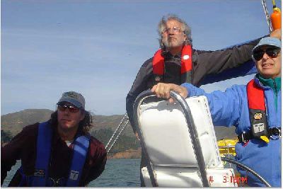
VALIS is getting ready for the Pacific Cup!   On Friday, Apr 11, Daniel T, Alan B, and I met onboard VALIS to review the systems and rigging, and any changes necessary.  We were joined by our rigger J.P. (J.P. Boatworks, Sausalito – whom I highly recommend).  We went over the boat from stem to stern, and J.P. went to the top of the mast, for a preliminary inspection.  We’ve now got a list of items to be added, changed, repaired, inspected, etc, and a schedule deadline for haulout.  VALIS is looking good, but we will be changing the foreguy rigging, adding a reaching strut (especially useful now that we won’t be racing with the asymmetrical spinnakers), improving the preventer rigging, and about a dozen other items.

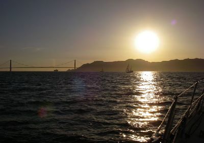
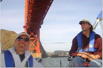
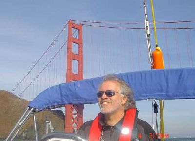
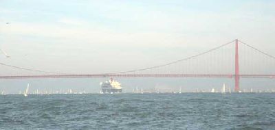
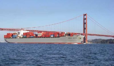
After J.P. had filled his notepad with things to do, Daniel, Alan, and I took VALIS out for a brief sail on the bay.  We tacked back and forth across the bay, under the Golden Gate Bridge, and out past Mile Rock.  We then ran back into the bay, past an incoming tanker (empty???) and an outgoing container ship, the Genoa Bridge.  Once under the bridge, we rounded Alcatraz and headed for home as the sun was setting on a spectacular day.

Attached is the Google Earth .kmz file showing our tracks and those of the AIS-equipped ships in our vicinity:

2008 Apr 11.kmz

Friday2.jpg

Friday1.jpg

Comments Comments | Categories: AIS, Pacific Cup 2008, VALIS General Stuff | Autor: ubik


December 25, 2007

Pacific Cup 2008 – Thoughts

As I promised, some more musings:

During the ’06 race, we made some decisions that in hindsight could have been better. I allowed my optimism to take us too far northwest and into the southeast ridge of the Pacific High. I was following the guideline that “slower boats should sail closer to the rhumbline”, and was gambling on some suggestions that the Pac High would shift further north than the forecasts were predicting. Perhaps this would have paid off some other year, but it certainly didn’t in ’06.

Just as bad, we didn’t know how badly our speed would suffer when we were running dead downwind. There will be an optimum angle (depending on windspeed), and we were much too conservative — we should have sailed at hotter angles. Chalk this up to lack of experience, and we will want to have much better information on this aspect of VALIS’ performance.

Rich mentioned “Expedition” — this is a navigation and weather-routing program that I recently purchased. The navigation part of the race is fairly trivial (at least unless the GPS satellites get shot down), but Expedition does this as well or better than the Raymarine program I used in 2006. Where Expedition shines for us is in its weather-routing capabilities. Expedition is able to take the gribfiles (“GRIdded Binary” weather predictions) that we get via radio email while at sea, and using the polars (which describe how fast the boat goes under varying wind speeds and angles), it will calculate the best course to sail. The Raymarine program also did this, but it was buggy and didn’t work nearly as well.

This is all good, but there are some caveats. GIGO still applies. Even the most carefully collected and calculated polars are at best an approximation of real-world performance, and the data I have for VALIS is pretty rough. Also important is the sea-state — swell height, shape, and direction all have an impact on sailing performance. A serious racing program will have collected this type of data, but guess what: I’m not that serious!
Even more important, the weather predictions are pretty good for a few days out, and progressively become more chaotic the further out you try to guess. Since the race will last perhaps 13 days, what looked like a good strategy at the start can become pretty bad halfway through.

“No battle plan ever survives contact with the enemy.” – Field Marshall Helmuth Carl Bernard von Moltke.
Still, you need to have a strategy, and Expedition gives us some good tools to use as we build ours, and adjust it to meet the evolving conditions. I do have performance logs from our 2006 Pac Cup race that were collected by the custom software I ran on my PocketPC, and I will be crunching that data to put together the polar data for VALIS. We will fine-tune this information during our pre-race sailing, and we can even adjust it during the race if we discover that our actual performance is much different from the predicted.

I also have saved all the GRIB files from the ’06 race, and can use these with Expedition to help validate our polars against the recorded data.

As Rich suggested, you can download a trial version of Expedition, or a reduced-capability version, from their website: http://www.iexpedition.org/

In addition to tactics and strategy, we also need a philosophy. Mine is to race as well as we can, but only as long as we are enjoying ourselves. The new spinnakers we will be flying should help, as should the larger crew.

Please don’t think that I’ve forgotten what this is really about: Sailing. I am looking forward to a glorious experience as we sail down the chilly coast and through the warm tradewinds towards Hawaii.

Merry Christmas!
-Paul
Comments Comments | Categories: Pacific Cup 2006, Pacific Cup 2008 | Autor: ubik


April 20, 2007

Photos From Feb 4 — Queen Mary 2

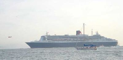
Here are some photos from our jaunt out to see the Queen Mary 2 as she
entered San Francisco Bay. On board we had Paul and Mary Elliott,
Daniel Terhune and his daughter Brook, Chick Petersen and Deborah
Parrish, and Paul Grossman. Daniel and Paul G. have sailed many miles
on VALIS: Paul was crew on our 2002 voyage to Hawaii, and Daniel crewed
in 2002 to Hawaii, and back to San Francisco, as well as to Hawaii in
the 2006 Pacific Cup.

image001.jpg
Deborah (our designated photographer)

image002.jpg
Daniel and Brook

image003.jpg
Chick and Daniel admiring the G.G. Bridge

image004.jpg
Paul E. (me) enjoying the occasion

image005.jpg
Daniel, Paul E, Paul G – searching for the QM2

image006.jpg
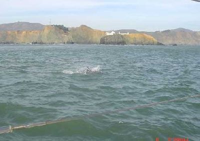
A calm day off Pt. Bonita, with dolphins

image007.jpg
QM2 being escorted in

image008.jpg
QM2 and her welcoming committee

Comments Comments | Categories: VALIS General Stuff | Autor: ubik


February 4, 2007

Sailing Feb 4 – Escorting the Queen Mary 2 Into S.F. Bay

Here is the Google Earth file showing our excursion around the bay,
including a jaunt out into the Pacific to welcome the Queen Mary 2.
Unfortunately, my camera malfunctioned, so images here will have to
wait.

We left Sausalito around 11:00AM, and motored or sailed (under genoa
only because the main is still at the loft), around Angel Island, out
the Gate past Pt. Bonita and a bit north, then turned and chased the
Queen Mary back into the bay. Along the way we had several pods of
dolphins visit, which was a treat. The weather was pleasant, seas
mostly calm, currents moderate. There were many boats on the bay and
out in the channel – easily as many as during fleet week or previous
tall ships events. We were back in the slip around 5:00PM.

A great day on the water!

-Paul

Feb-04-2007.kmz

Comments Comments | Categories: AIS, VALIS General Stuff | Autor: ubik


November 23, 2006

More AIS and Google Earth Examples

Here is a Google Earth “KMZ” file that shows the AIS data received at my
house from the ships entering and leaving San Francisco Bay. This data
was collected from Nov 14 through Nov 22, with some gaps here and there.
I’ve been working on my program that creates the Google Earth files from
the raw AIS data, and it is now pretty easy to investigate the ship
traffic.
Some points of interest:
“F/V SHELLFISH” – It looks like they are dropping and picking up crab
pots (crab season has just opened).
“PV CALIFORNIA” and “PVSANFRANCISCO” – see these pilot vessels intercept
the ships arriving and departing as the pilot boards and leaves.
“R/V FULMAR” – this new NOAA research vessel is circling the Farallon
Islands.
It is also interesting to see the holes in my radio reception. Lately,
I haven’t been able to get any signals near the Golden Gate Bridge.
There is a gap in the tracks in this area.
-Paul

nov 14-22.kmz

Comments Comments | Categories: AIS | Autor: ubik


October 7, 2006

Oct 7 Fleet Week Sail

We took VALIS out to Alcatraz for Fleet Week, and what an interesting
day it was! In addition to some impressive ships, and some amazing
demonstrations of air power and grace, we learned first-hand (again)
what boaters mean when they say that anchoring is the second-most
stressful thing we do (anchoring next to dozens of other boats with
changing current and wind is the most stressful). Last year we were
lucky, I guess – while we saw several incidents we had none of our own.
This year, we participated in several of these “incidents”. It would be
interesting to hear the other fellow’s version of the story (if I could
keep from killing him first), but in any case, we lost an anchor, and
experienced both the bad and the good sides of several people.

After all was said and done, we still had a great time, and made it back
to our slip with everyone still intact. I will post some photos in a
few days, but in the meantime you might want to look at this Google
Earth “kmz” file showing the track of VALIS, and the tracks of all the
AIS-equipped ships on the bay during the festivities. VALIS’ track is
in yellow, and the other ships are in white. You can select individual
ship tracks to display or not. I don’t see any of the Navy ships here -
I guess they don’t feel that continuously broadcasting their course,
speed, and position is a good idea.

-Paul

VALIS – Fleet Week Oct 7 2006.kmz

Comments Comments | Categories: AIS, VALIS General Stuff | Autor: ubik


October 5, 2006

More Google Earth / AIS Stuff

After playing with this stuff for several days, I have added some cool
features to my AIS data postprocessor programs. Many of them are
invisible, added to make the system more convenient, but one nice
feature is that each ship now has all its tracks combined into a
“folder”, allowing you to show or hide tracks for individual ships.
Clicking on the endpoints of each track shows interesting information
about the ship. In this file, ship position data is captured once every
ten minutes.
Here (attached) is the Google Earth “.kmz” file with the output from
several days of monitoring. The areas from where I get good signals
show up pretty clearly. By the way, the receiver was not running
continuously during this monitoring period.
-Paul

AisTracks05102006.kmz

Comments Comments | Categories: AIS | Autor: ubik


September 29, 2006

AIS and Google Earth

Lately I’ve been working with AIS (Automatic Identification System)
tools and hardware for VALIS. AIS is a system used to track ships using
VHF transmitters and receivers. Ships broadcast their position, speed,
course, etc, and we can receive these signals, allowing us to anticipate
close encounters and make necessary course changes. AIS is a
breakthrough technology, and I will be writing more about it.

Recently, I procured a second AIS receiver for use at home as I refine
my AIS software and hardware. I have been very impressed with the
receiver range, and have been using my Pocket PC to capture and store
the received AIS data. With a thrown-together post-processing program,
I can make Google Earth track files from the saved data. Here are some
images, showing ship traffic over the past couple of days:

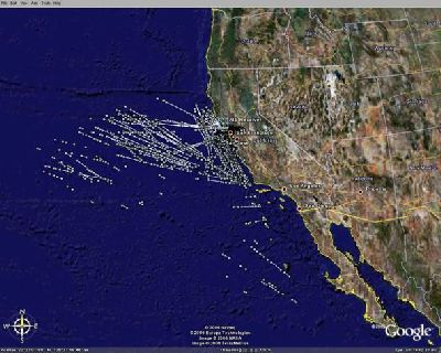
image001.jpg
Note that this is well beyond line-of-sight – probably tropospheric
ducting propagation

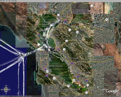
image002.jpg
Zoomed in on San Francisco Bay area traffic

My program captures all active AIS targets (ships) at ten-minute
intervals, and draws a track line for each ship. If a target disappears
for a while, and then re-appears, a new track is started. You will
notice that some tracks cut over land in the north-bay area – these are
the high-speed ferries, and the combination of their speed and the very
poor signal strength from these location creates gaps in the tracks.

I am attaching the Google Earth “KMZ” file that was used to make these
pictures. Click on a track endpoint to to see the ship’s MMSI number
and the time/date. You can (usually) look up a ship’s MMSI and find the
ship particulars at this site:

http://www.itu.int/cgi-bin/htsh/mars/ship_search.sh

Have fun!
-Paul

AIS-Tracks.kmz

Comments Comments | Categories: VALIS General Stuff | Autor: ubik


September 17, 2006

Website Updated

I have added still more Pacific Cup / return voyage stuff to the VALIS
website. In addition to the photos, there are now videos and
commentary.
www.sailvalis.com
-Paul

Comments Comments | Categories: Pacific Cup 2006 | Autor: ubik


August 30, 2006

Hawaii 2006 Photos On The Web

I’ve finally got the Pacific Cup and return trip photos beaten into
shape, and have put them up on the VALIS website. Here is the link:
http://www.sailvalis.com/Pac%20Cup%2006/index.htm

Best,
Paul

Comments Comments | Categories: Pacific Cup 2006 | Autor: ubik