Offshore Overnight GoogleEarth Trackfile, AIS-monitoring program
Here is a Google Earth trackfile showing VALIS and the AIS-equipped ships in her vicinity:
2008 Apr 12-13.kmz
Also, here are some screenshots of the homebrew program I am using to monitor AIS traffic, as well as to monitor all the navsystem data aboard VALIS:
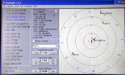
AIS Screen, showing “Gas Oriental” and VALIS ducking her stern
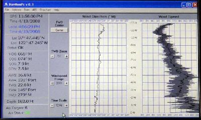
Windspeed and direction stripchart
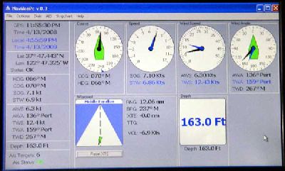
Navdata monitor