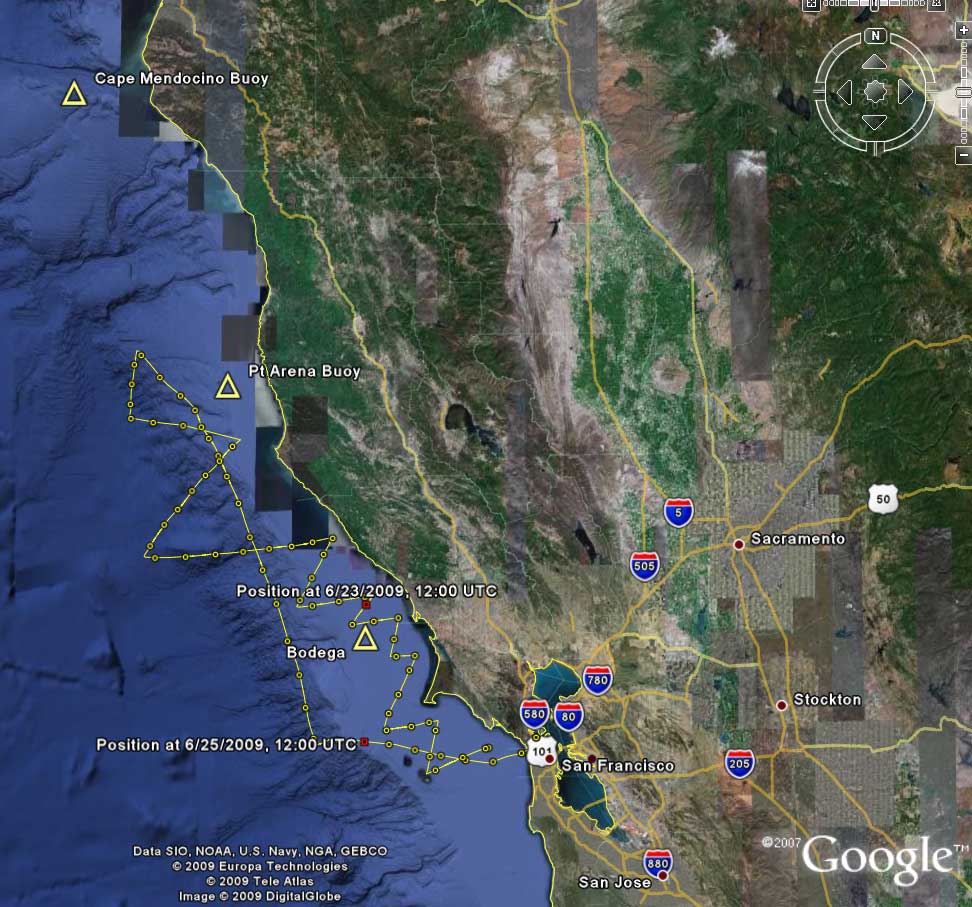
Google Earth Track – our northbound adventure
Here (attached) is the Google Earth “.kmz” file showing our track up and down the coast. You can also see the ships we were seeing with our AIS system. I have included placemarks for the major weather buoys along the San Francisco to Seattle route.
I swear that we can sail better tacking angles than you will see here! I’ve got the tracks to prove it! What we had going against us last week were big seas, a partially-furled roller-reefing genoa, a southbound current, and a boat loaded with cruising gear.
-Paul
The trackfile: VALIS to Seattle.kmz